
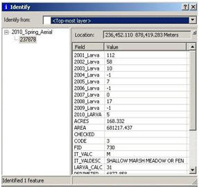
Aerial Larvicide
Wetlands are precisely delineated and a database provides information about the wetland, including type, area, and past larval data.

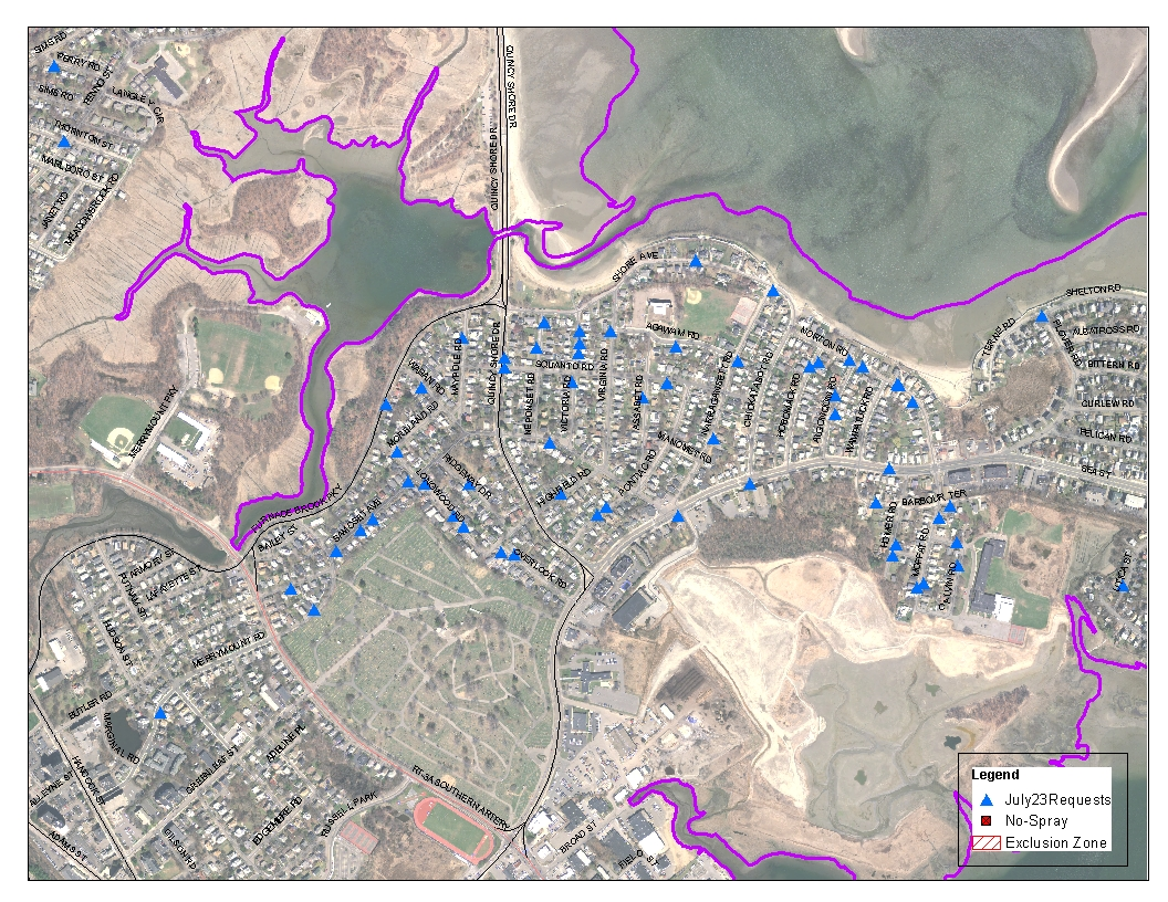
Resident Requests
When you make your request online, the address information is automatically mapped onto our GIS software. This allows us to see the location of requests as they come in which helps us quickly allocate resources to effectively deal with localized mosquito outbreaks.
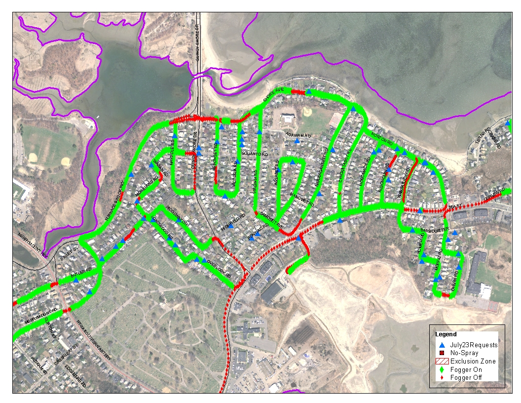
ULV Spray Routes
Our ULV spray routes are generated by the location of requests. In order to ensure good coverage, we generally spray a short distance (up to a half mile) on either side of a resident who’s made a request. We will also spray any side streets near the home or streets behind the home. In the case of a large number of requests in a certain area, we will spray entire neighborhoods. Maps will be created based on the request location and will be given to our field crew. The maps are also uploaded to our GPS system in each truck. Finally, the spray routes are uploaded to a searchable map on our website by 3:30 PM on the day your town is scheduled.
GPS Equipment
All of our trucks are equipped with GPS tracking equipment. The GPS tracks our ULV Application allowing us to determine what streets were treated, as well as the exact time, date, and treatment rate at any given location. All of this information is made available to the public for review. We continue to research the latest technology involving GIS and will incorporate these improvements into our daily activities.
Contact the GIS Department
NOTE: Please do not use this form to make requests for mosquito treatments. Those requests can be made here